
French Vintage Prints
1892 Alpes Maritimes Map
1892 Alpes Maritimes Map
Regular price
$35.00 USD
Regular price
Sale price
$35.00 USD
Unit price
per
Tax included.
Shipping calculated at checkout.
Couldn't load pickup availability
Materials
Materials
Dimensions
Dimensions
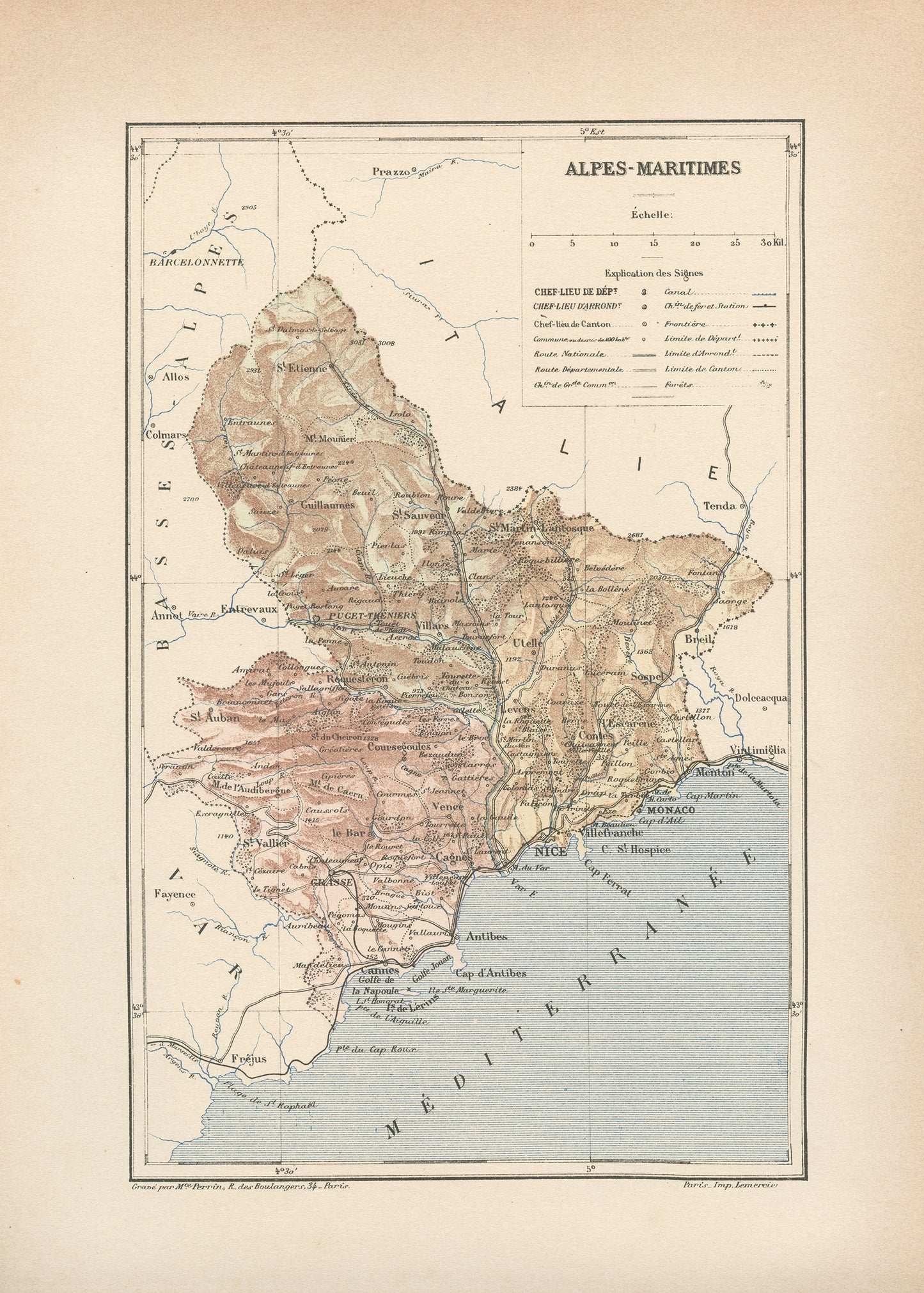
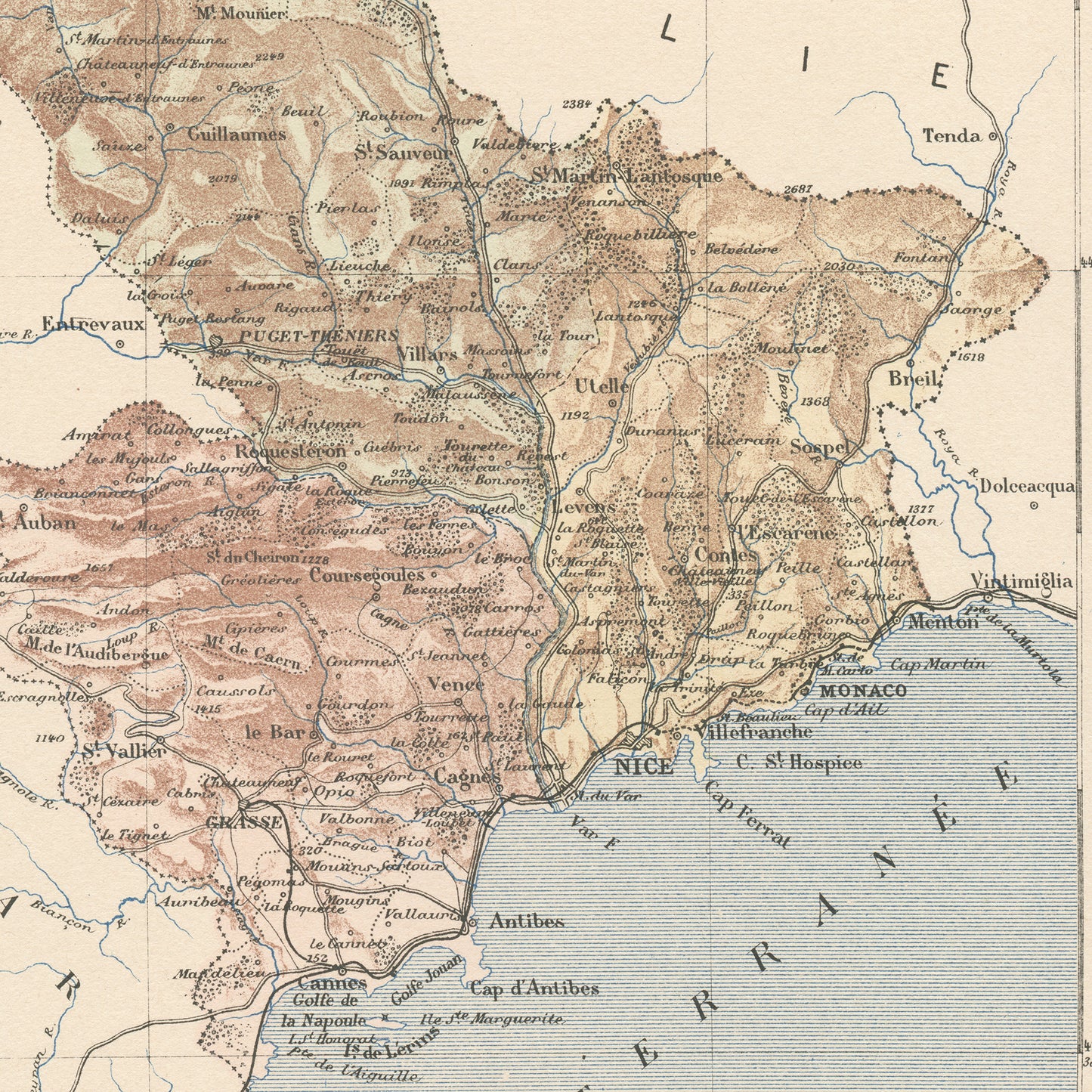
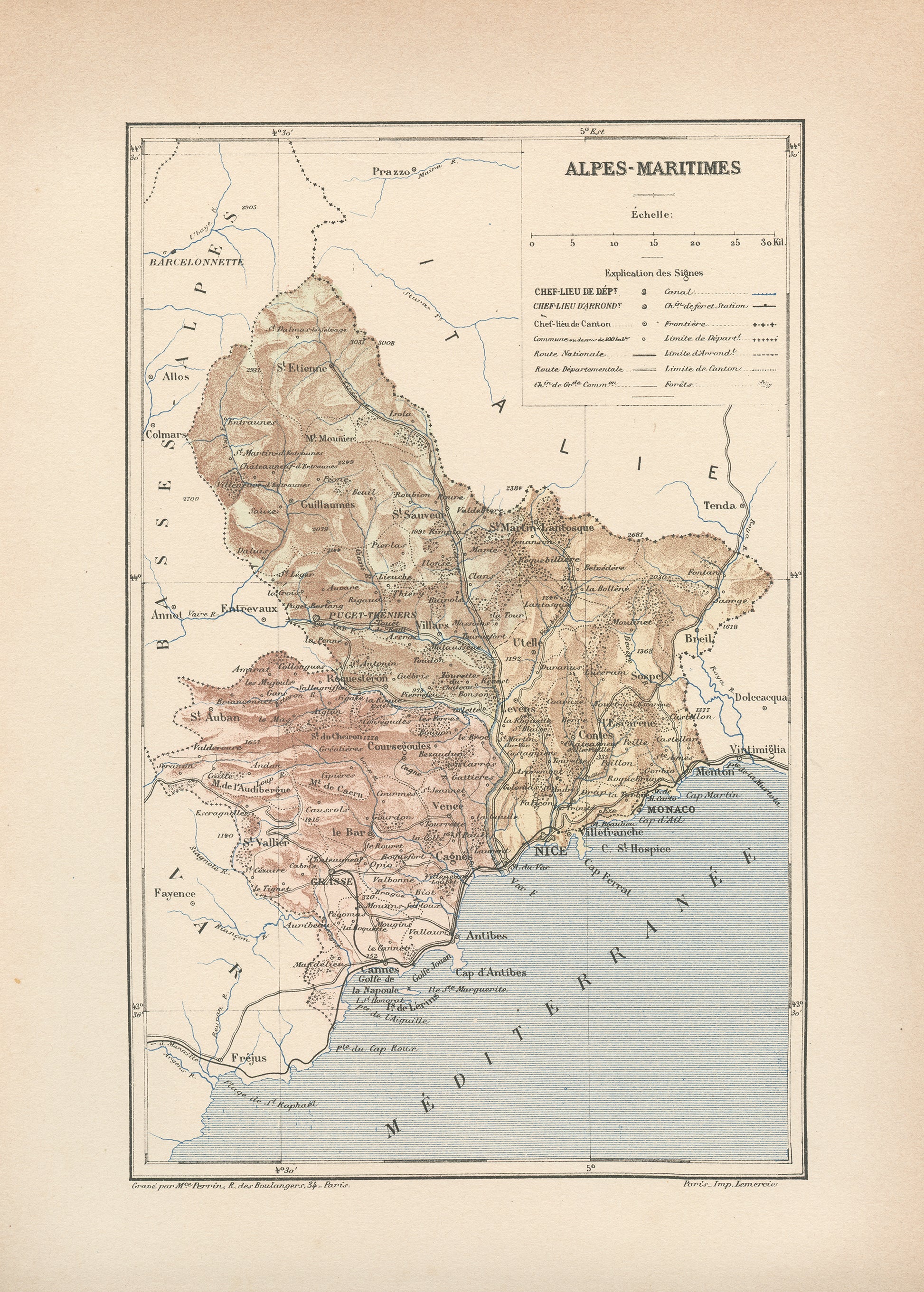
The French Riviera, known in France as the Côte d'Azur is definitely one of the most iconic French travel destination. It encompasses the extreme Eastern coast on the Mediterranean sea, stretching from the Cap Roux to Menton, at the Italian border and includes the cities of Antibes, Cannes and Nice. It also encloses Monaco.
This gorgeous little engraving shows a delicately colorized map of that beautiful French department: the Alpes Maritimes. As you may know, France is divided in 101 department. The capital city of this one is the city of Nice.
This dictionary page comes from a damaged 1892 French Trousset dictionary. It was engraved on thick paper.
SIZE : Page approx. 31 x 21.8 cm (12’’ 1/4 x 8’’ 1/2), margins included. Map approx. 23.5 x 15.2 cm (9’’ 1/4 x 6’’)
ORIGINAL : You will receive an authentic dictionary page from 1892, which comes from a damaged volume. This is NOT a copy. The paper is yellowed, as befits its age but the map is in very good condition.
SHIPPING : Ships in a cellophane bag and a cardboard-reinforced envelope. The mat and frame are NOT included.
View full details
This gorgeous little engraving shows a delicately colorized map of that beautiful French department: the Alpes Maritimes. As you may know, France is divided in 101 department. The capital city of this one is the city of Nice.
This dictionary page comes from a damaged 1892 French Trousset dictionary. It was engraved on thick paper.
SIZE : Page approx. 31 x 21.8 cm (12’’ 1/4 x 8’’ 1/2), margins included. Map approx. 23.5 x 15.2 cm (9’’ 1/4 x 6’’)
ORIGINAL : You will receive an authentic dictionary page from 1892, which comes from a damaged volume. This is NOT a copy. The paper is yellowed, as befits its age but the map is in very good condition.
SHIPPING : Ships in a cellophane bag and a cardboard-reinforced envelope. The mat and frame are NOT included.