

French Vintage Prints
1892 Antique Eure Map - France
1892 Antique Eure Map - France
Regular price
$39.00 USD
Regular price
Sale price
$39.00 USD
Unit price
per
Tax included.
Shipping calculated at checkout.
Couldn't load pickup availability
Materials
Materials
Paper
Dimensions
Dimensions
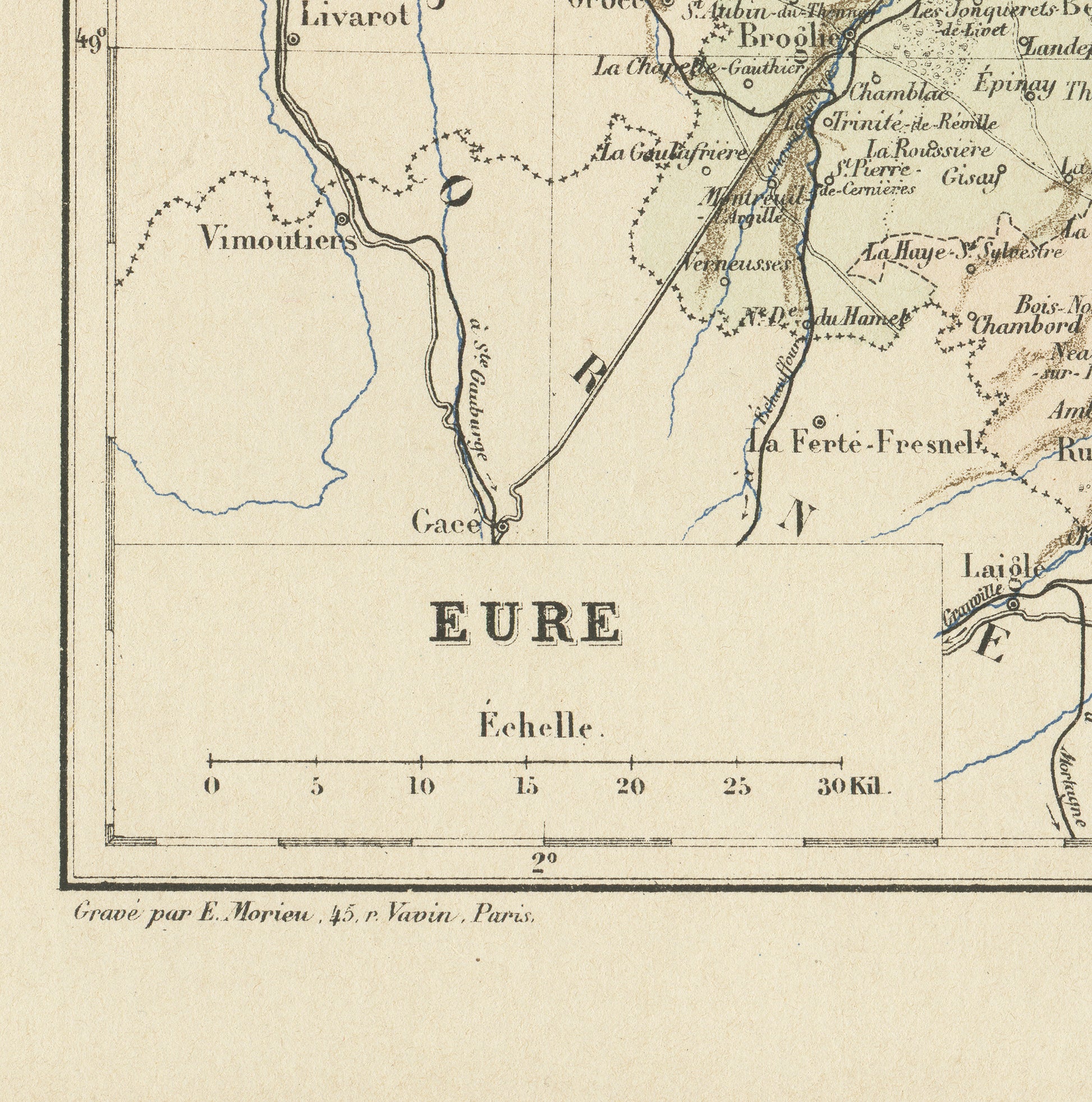
Page approx. 31 x 21.8 cm (12’’ 1/4 x 8’’ 1/2), margins included. Map approx. 23.5 x 15.2 cm (9’’ 1/4 x 6’’)
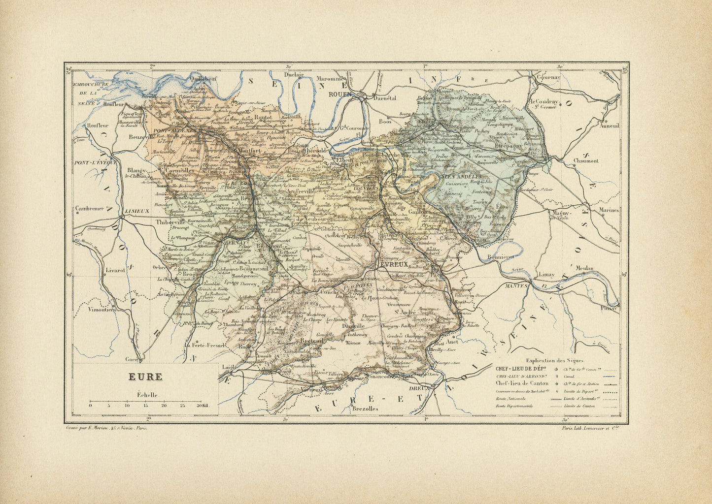
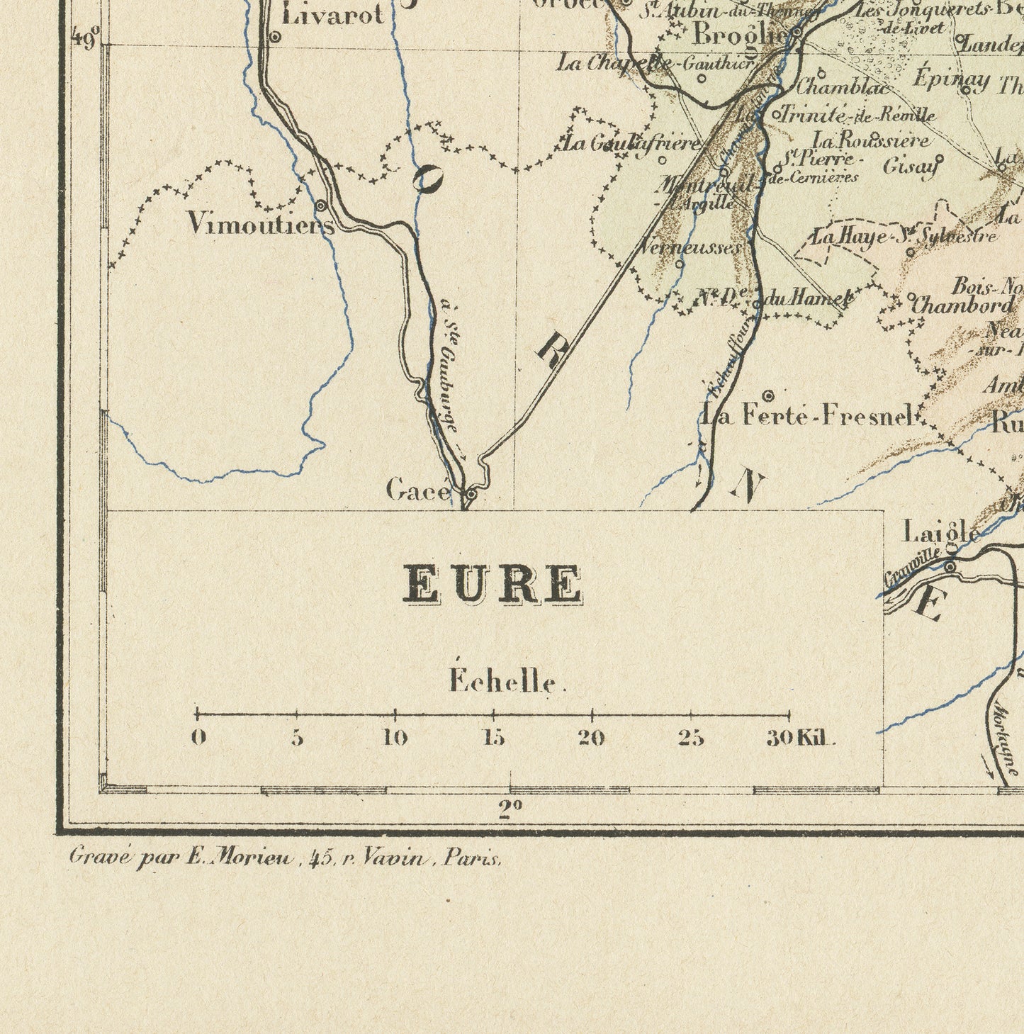
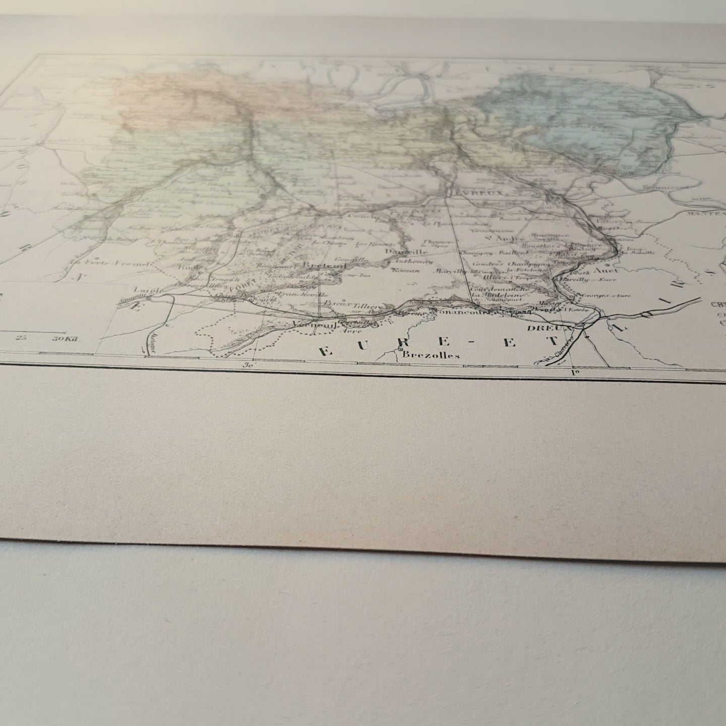
Gorgeous little engraving showing a delicately colorized map of a French department: the Eure department. Do you know where it is situated? As you may know, France is divided in 101 department. This one is in the west of France, in the Normandy region. Its prefecture (main administrative center) is the city of Evreux. Well-known cities also include Les Andelys, Pont-Audemer, Louviers or Breteuil.
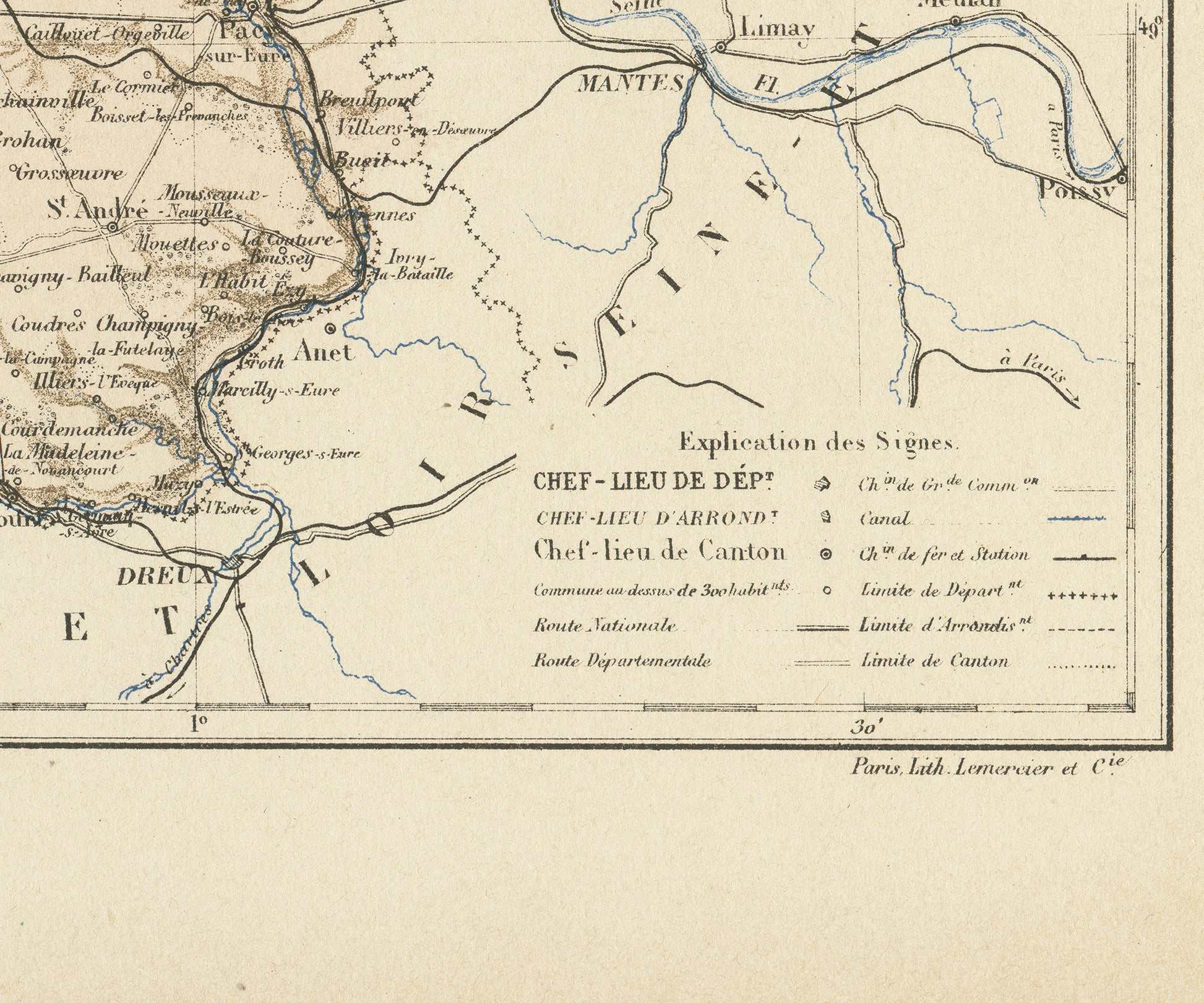
This dictionary page comes from a rare damaged 1892 French Trousset dictionary. It was engraved on thick paper. Under the map, there are in both bottom corners mentions of the company which engraved it (Paris Lith. Lemercier & Cie) and even of the person who did the actual engraving (E. Morieu, who lived 45, rue Vavin in Paris). Isn't that perfect?
SIZE : Page approx. 31 x 21.8 cm (12’’ 1/4 x 8’’ 1/2), margins included. Map approx. 23.5 x 15.2 cm (9’’ 1/4 x 6’’)
AUTHENTICITY : You will receive an authentic dictionary page from 1892, which comes from a damaged volume. The paper is yellowed, as befits its age but the map is in very good condition.
SHIPPING : Your prints ship in a cellophane bag and a cardboard-reinforced envelope. The mat and frame are NOT included.
View full details
This dictionary page comes from a rare damaged 1892 French Trousset dictionary. It was engraved on thick paper. Under the map, there are in both bottom corners mentions of the company which engraved it (Paris Lith. Lemercier & Cie) and even of the person who did the actual engraving (E. Morieu, who lived 45, rue Vavin in Paris). Isn't that perfect?
SIZE : Page approx. 31 x 21.8 cm (12’’ 1/4 x 8’’ 1/2), margins included. Map approx. 23.5 x 15.2 cm (9’’ 1/4 x 6’’)
AUTHENTICITY : You will receive an authentic dictionary page from 1892, which comes from a damaged volume. The paper is yellowed, as befits its age but the map is in very good condition.
SHIPPING : Your prints ship in a cellophane bag and a cardboard-reinforced envelope. The mat and frame are NOT included.