French Vintage Prints
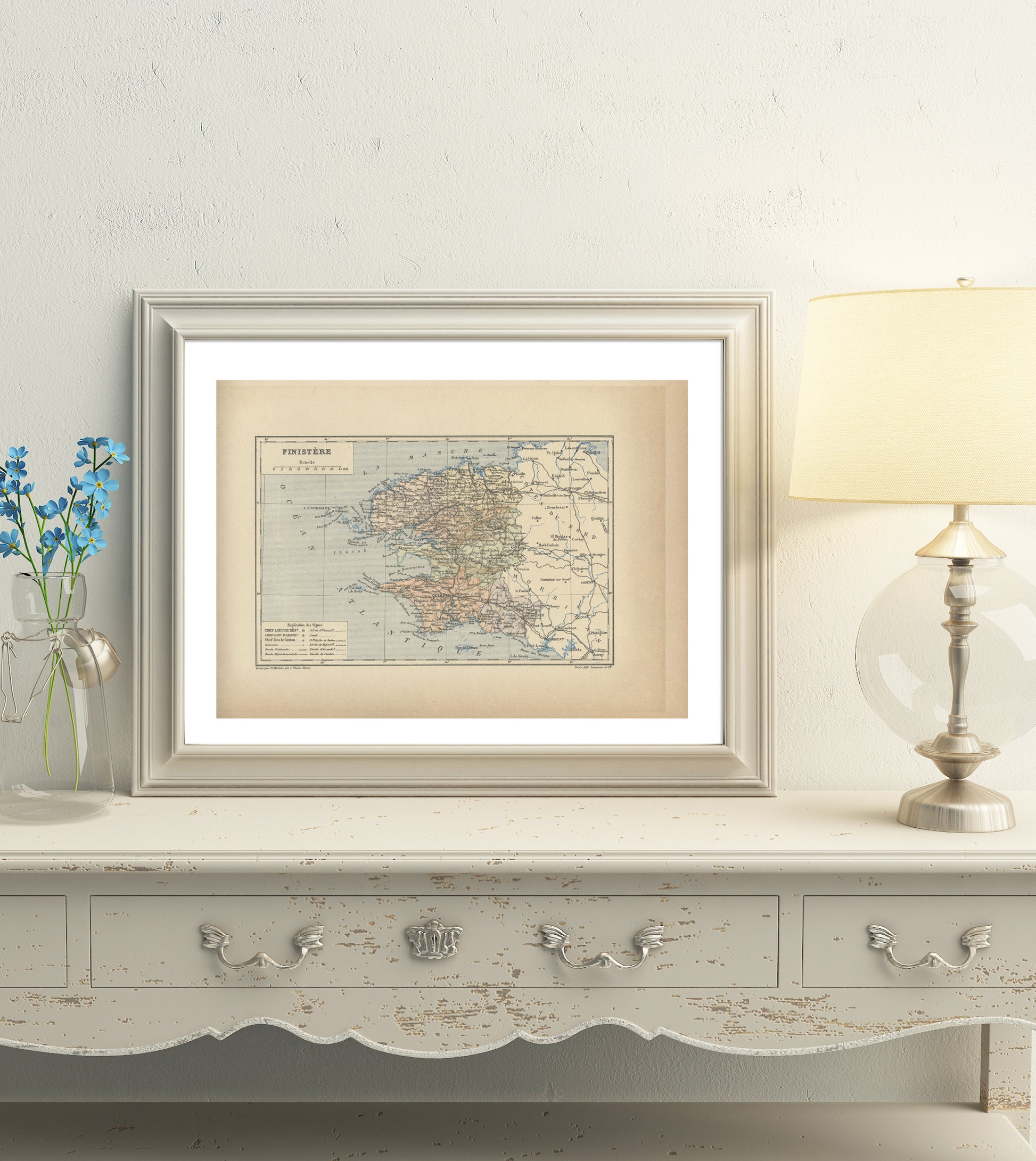
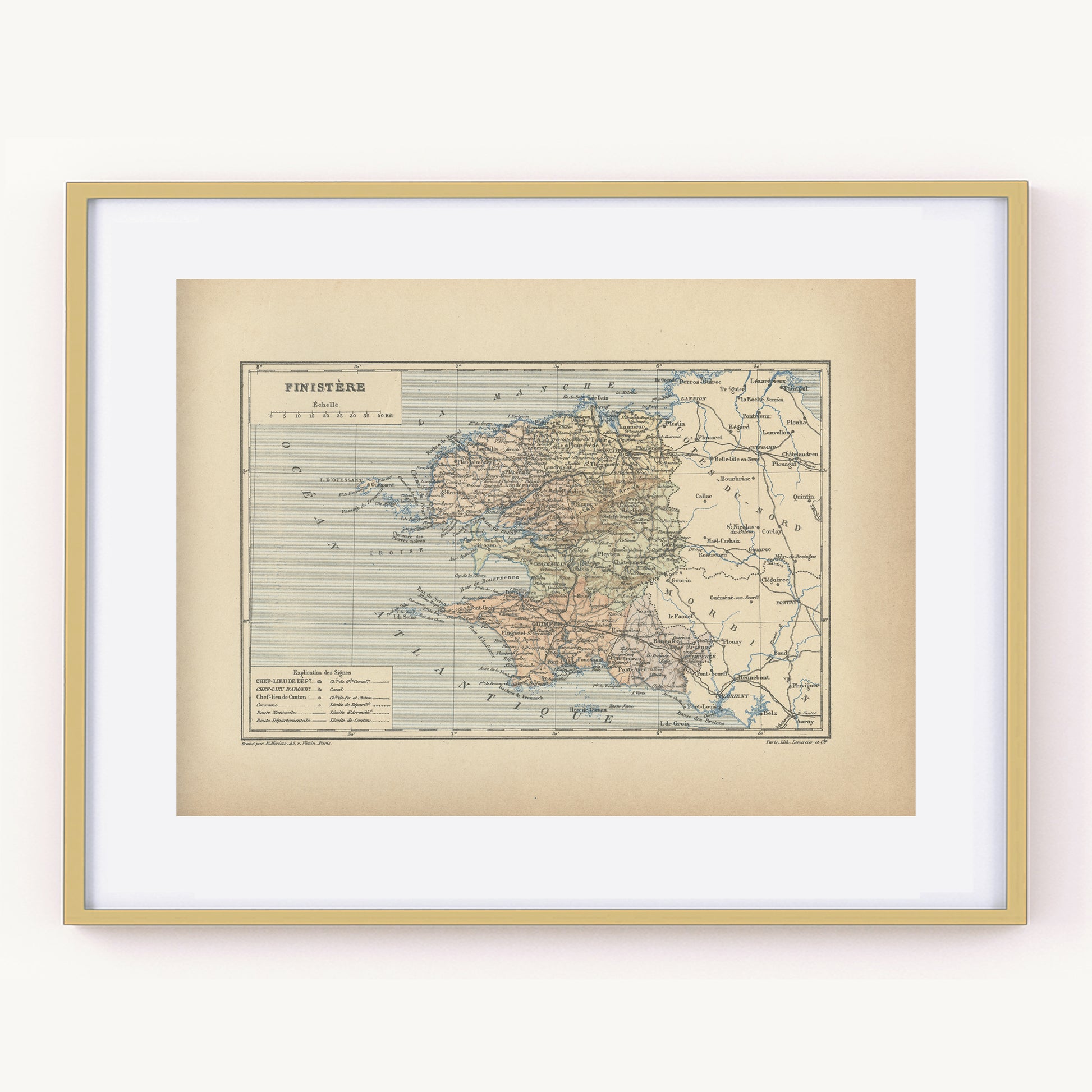
1892 Antique Map of Finistère - France
1892 Antique Map of Finistère - France
Regular price
$39.00 USD
Regular price
Sale price
$39.00 USD
Unit price
per
Tax included.
Shipping calculated at checkout.
Couldn't load pickup availability
Materials
Materials
Paper
Dimensions
Dimensions
Page approx. 31 x 21.8 cm (12’’ 1/4 x 8’’ 1/2), margins included. Map approx. 23.5 x 15.2 cm (9’’ 1/4 x 6’’)
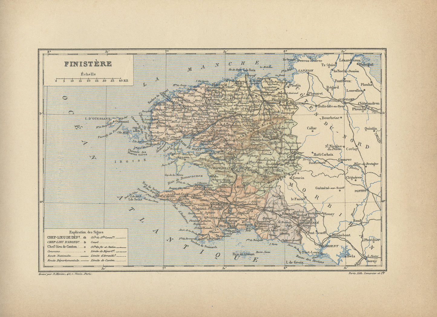
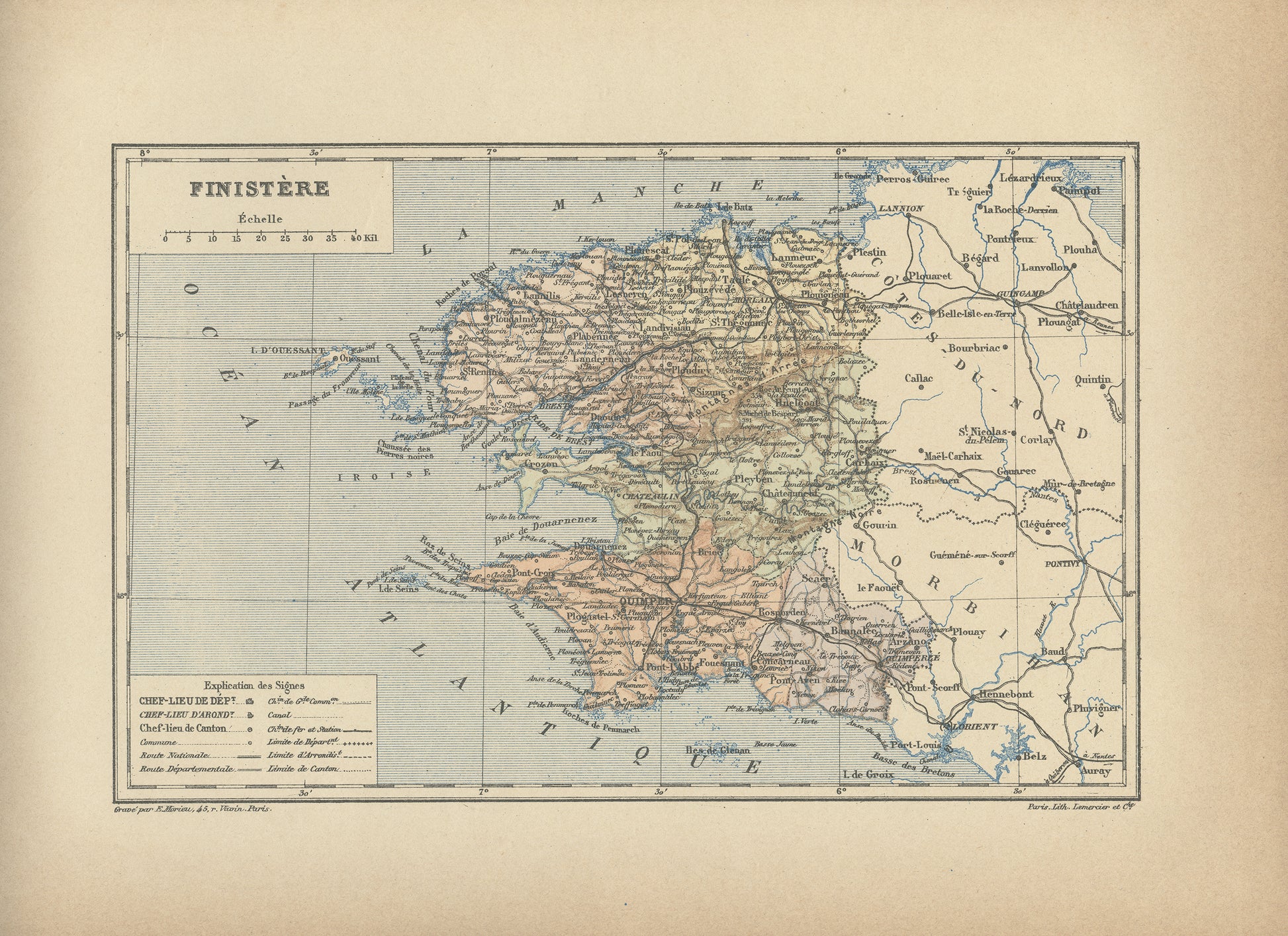
Are you a fan of the Tour de France? Then you'll know everything about the geography of France. Gorgeous little engraving showing a delicately colorized map of a French department: the Finistère department. Do you know where it is situated? As you may know, France is divided in 101 department. This one is the westernmost, in Brittany, on the Channel and Atlantic coastline The capital city is the beautiful town of Quimper. Famous coastal towns include the port of Brest, the island of Ouessant or the Pointe du Raz.
This dictionary page comes from a rare damaged 1892 French Trousset dictionary. It was engraved on thick paper. Under the map, there are in both bottom corners mentions of the company which engraved it (Paris Lith. Lemercier & Cie) and even of the person who did the actual engraving (E. Morieu, 45 r Vavin in Paris). Isn't that perfect?
-------
SIZE
-------
Page approx. 31 x 21.8 cm (12’’ 1/4 x 8’’ 1/2), margins included. Map approx. 23.5 x 15.2 cm (9’’ 1/4 x 6’’)
-------------------------
AUTHENTICITY
-------------------------
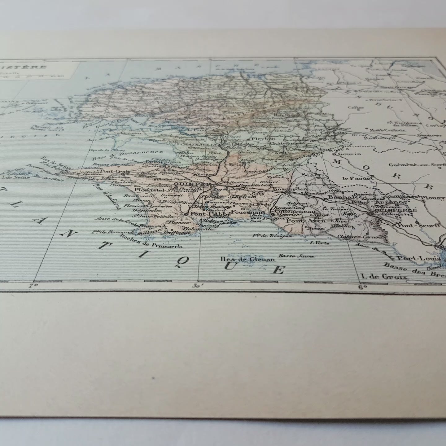
You will receive an authentic dictionary page from 1892, which comes from a damaged volume. The paper is yellowed, as befits its age but the map is in very good condition.
-----------------
SHIPPING
-----------------
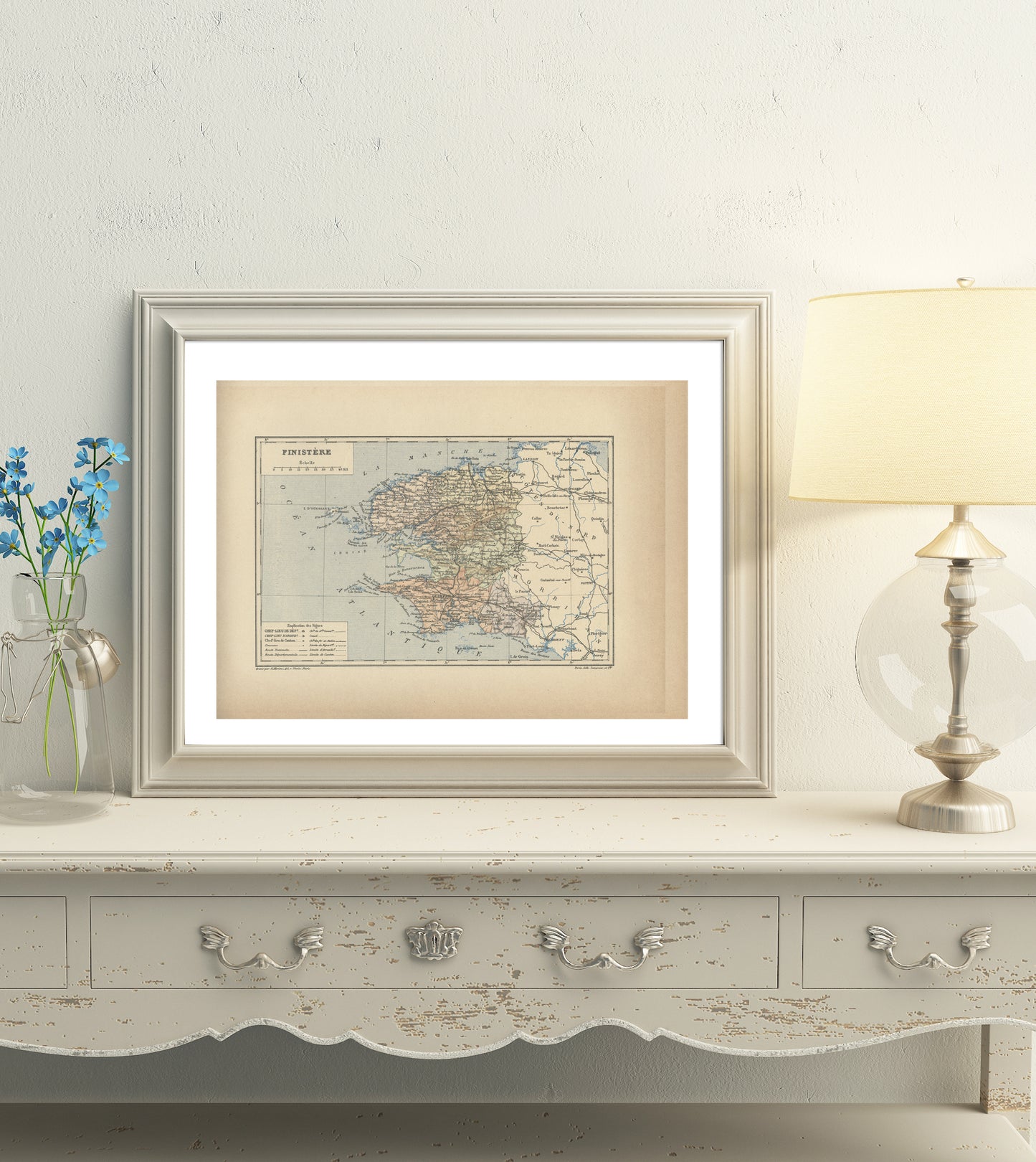
Your prints will ship in a sealed cellophane bag and a cardboard-reinforced envelope. The mat and frame are NOT included.
ONLY ONE IN STOCK
View full details
This dictionary page comes from a rare damaged 1892 French Trousset dictionary. It was engraved on thick paper. Under the map, there are in both bottom corners mentions of the company which engraved it (Paris Lith. Lemercier & Cie) and even of the person who did the actual engraving (E. Morieu, 45 r Vavin in Paris). Isn't that perfect?
-------
SIZE
-------
Page approx. 31 x 21.8 cm (12’’ 1/4 x 8’’ 1/2), margins included. Map approx. 23.5 x 15.2 cm (9’’ 1/4 x 6’’)
-------------------------
AUTHENTICITY
-------------------------
You will receive an authentic dictionary page from 1892, which comes from a damaged volume. The paper is yellowed, as befits its age but the map is in very good condition.
-----------------
SHIPPING
-----------------
Your prints will ship in a sealed cellophane bag and a cardboard-reinforced envelope. The mat and frame are NOT included.
ONLY ONE IN STOCK