
French Vintage Prints
1892 Gard Map
1892 Gard Map
Regular price
$38.00 USD
Regular price
Sale price
$38.00 USD
Unit price
per
Tax included.
Shipping calculated at checkout.
Couldn't load pickup availability
Materials
Materials
Paper
Dimensions
Dimensions
Page approx. 31 x 21.8 cm (12’’ 1/4 x 8’’ 1/2), margins included. Map approx. 23.5 x 15.2 cm (9’’ 1/4 x 6’’)
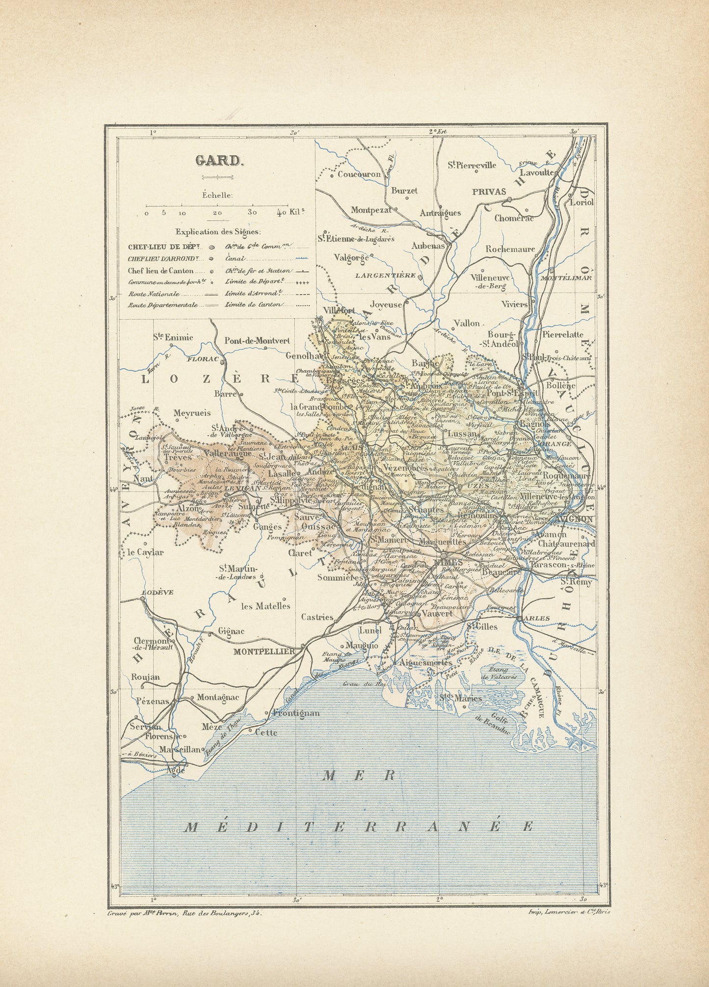
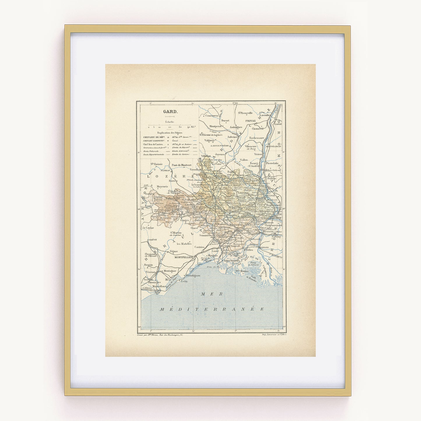
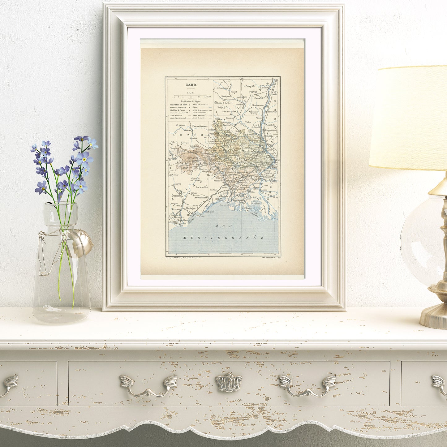
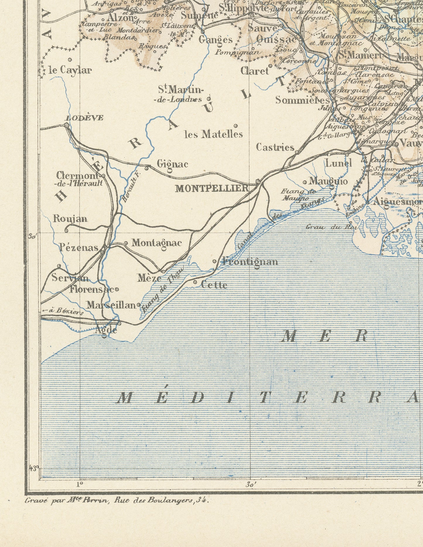
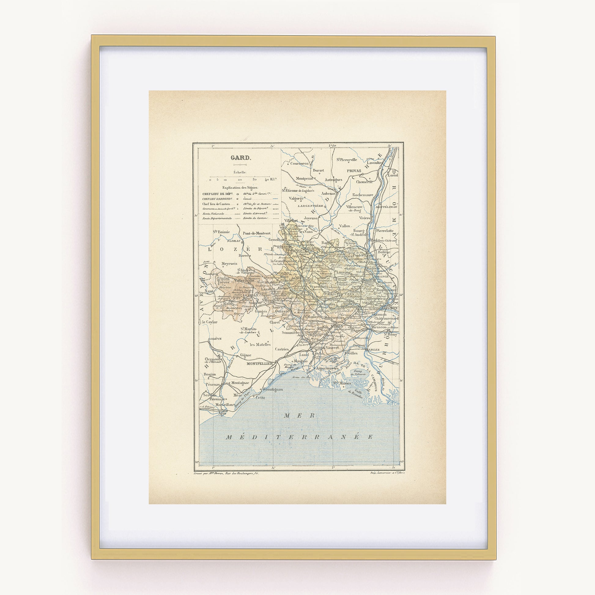
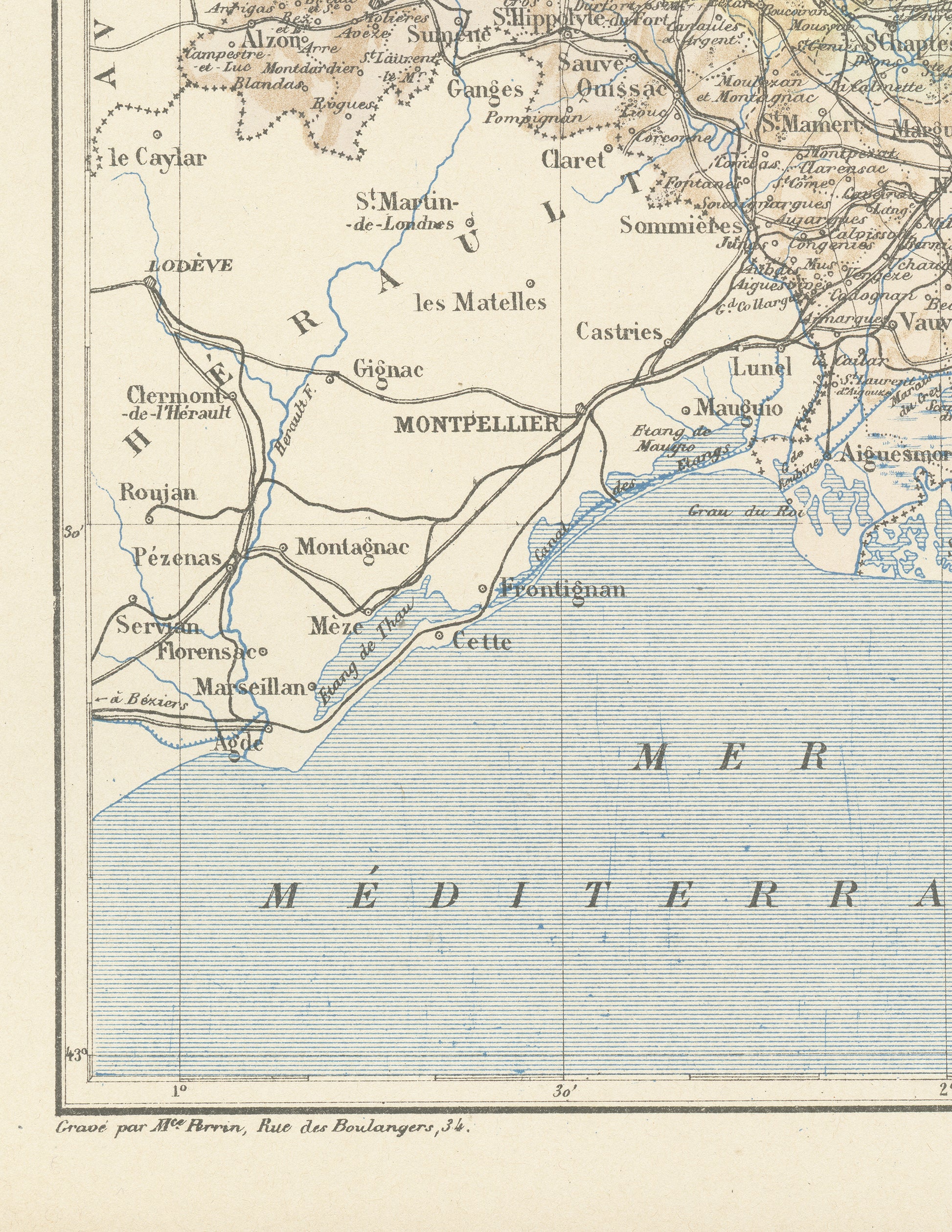
Gorgeous little 19th century engraving from a French geography dictionary showing a delicately colorized map of a French department: the Gard department. Do you know where it is situated? As you may know, France is divided in 101 department. This one is in the South West. Its prefecture (main administrative center) is the city of Nîmes, which is famous for its antique arenas. It is also famous for the Pont du Gard, a large Roman aqueduct.
This dictionary page comes from a rare damaged 1892 French Trousset dictionary. It was engraved on thick paper.
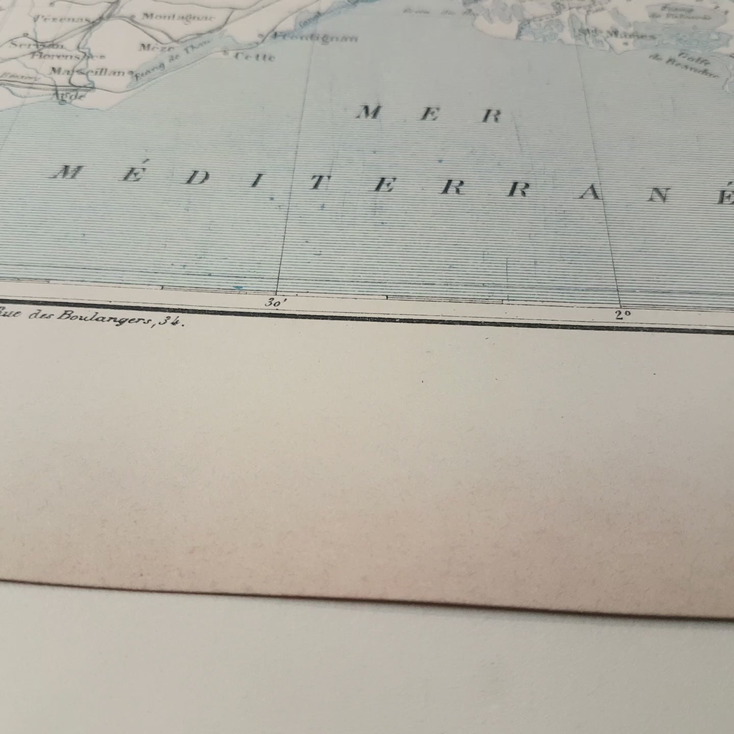
Under the map, there are in both bottom corners mentions of the company which engraved it (Paris Lith. Lemercier % Cie) and even of the person who did the actual engraving (Mce. Perrin, who lived Rue des Boulangers, 34 in Paris).
SIZE: Page approx. 31 x 21.8 cm (12’’ 1/4 x 8’’ 1/2), margins included. Map approx. 23.5 x 15.2 cm (9’’ 1/4 x 6’’)
Isn't that perfect?
----------------------
AUTHENTICITY
---------------------
You will receive an authentic dictionary page from 1892, which comes from a damaged volume. The paper is yellowed, as befits its age but the map is in very good condition.
-----------------
SHIPPING
-----------------
Your prints ship in a cellophane bag and a cardboard-reinforced envelope. The mat and frame are NOT included.
View full details
This dictionary page comes from a rare damaged 1892 French Trousset dictionary. It was engraved on thick paper.
Under the map, there are in both bottom corners mentions of the company which engraved it (Paris Lith. Lemercier % Cie) and even of the person who did the actual engraving (Mce. Perrin, who lived Rue des Boulangers, 34 in Paris).
SIZE: Page approx. 31 x 21.8 cm (12’’ 1/4 x 8’’ 1/2), margins included. Map approx. 23.5 x 15.2 cm (9’’ 1/4 x 6’’)
Isn't that perfect?
----------------------
AUTHENTICITY
---------------------
You will receive an authentic dictionary page from 1892, which comes from a damaged volume. The paper is yellowed, as befits its age but the map is in very good condition.
-----------------
SHIPPING
-----------------
Your prints ship in a cellophane bag and a cardboard-reinforced envelope. The mat and frame are NOT included.